Feeds:
Posts
Comments

Posts Tagged ‘NSF’

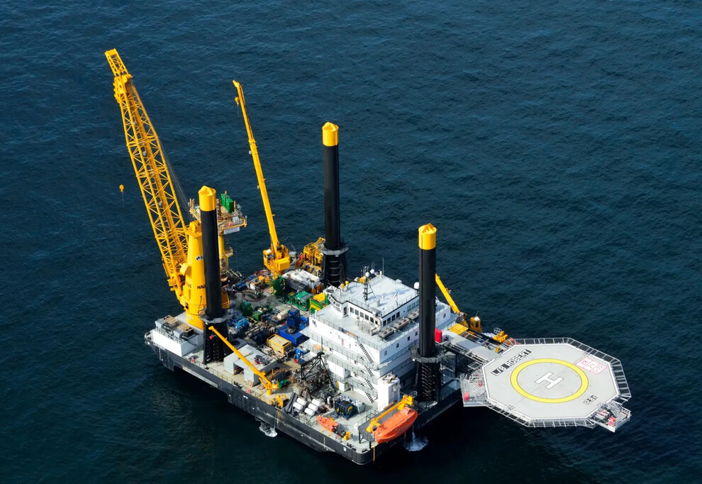
Excerpt from the expedition summary:

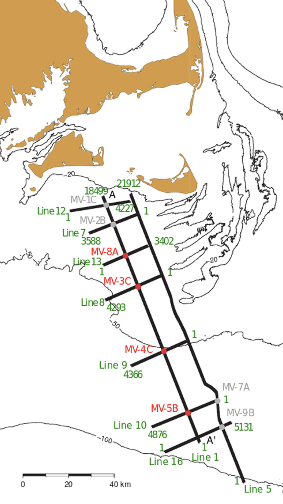
The northeast coast of the United States is perhaps the best understood example of an offshore freshwater system, and multiple studies have been undertaken to determine the origin and volume of offshore freshwater. Coring and sampling the subseafloor offshore Massachusetts, USA, will provide data for understanding the processes driving emplacement of freshwater lenses offshore New England and elsewhere globally, and lead to a better understanding of this worldwide hydrogeological phenomenon. This is essential for protection and sustainable management of offshore freshwater systems and for better understanding biogeochemical and elemental cycling in continental shelf environments.

With regard to the potential freshwater resources (from the Nantucket Current):

“I’m just excited about the science, and that finally, after all these years, someone’s trying to get the truth,” said Nantucket Water Department director Mark Willett. “Computers predicted it. Everybody thinks it’s there. These guys are the first ones in the world who are going to go drill a hole and prove it.”

Willett and (lead scientist Brandon) Dugan are particularly intrigued by the possibility that the offshore freshwater aquifer could be connected to a lower, untapped aquifer beneath Nantucket that Willett calls “ancient glacier lake Nantucket.”

“If it is connected and it’s young water that’s being recharged actively today, that’s really exciting, because it’s a renewable source,” Dugan said.

The liftboat Robert will drill 3 wells to depths of 300-400 feet between May 1 and August 32.

Read Full Post »

Just as I was lamenting the absence of scientific surveying in the Atlantic, my former colleague Renee Orr brought this NOAA announcement to my attention. Researchers from the University of Texas Institute of Geophysics and Lamont-Doherty Earth Observatory, with funding from the National Science Foundation, propose to conduct seismic surveys in the Blake Plateau area of the South Atlantic (map below).

The proposed study would acquire two-dimensional (2-D) seismic reflection and seismic refraction data to examine the structure and evolution of the rifted margins of the southeastern United States, including the rift dynamics during the formation of the Carolina Trough and Blake Plateau.

The survey will lead to a better understanding of “the interaction between tectonic and magmatic processes that led to continental breakup and the onset of seafloor spreading in the central Atlantic Ocean 200 million years ago.” The investigators are particularly interested in the “stratigraphy of sediments that formed during and after rifting, the degree of crustal stretching at the continental margins, crustal faults that formed during extension of the margin, and the geometry of lava flows that were placed on the crust before the start of seafloor spreading.”

While not a primary purpose, the research should improve our understanding of the relationship between productive oil and gas fields offshore Africa and US analogs. Paul Post and his BOEM team estimated that the US Atlantic could contain >20 billion BOE (link to the latest report).

NOAA has conducted a detailed review of the proposal and made a “preliminary determination that the impacts resulting from this activity are not expected to adversely affect any of the species or stocks through effects on annual rates of recruitment or survival.”

Read Full Post »