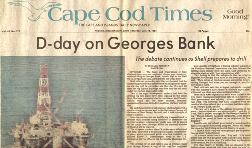
44 years ago today, drilling began on the first two exploratory wells on Georges Bank, the large seafloor feature that separates the Gulf of Maine from the Atlantic Ocean. The above Cape Cod Times headline attests to the drama that was unfolding 155 miles southeast of Nantucket.
After years of debate, oil embargoes, gas lines, and the threat of future supply disruptions tipped the political balance in favor of offshore leasing, and OCS Sale No. 42 (North Atlantic) was held one week before Christmas in 1979. Remarkably, only 19 months elapsed between the lease sale and the initiation of drilling.
The District Court of Amsterdam has ordered Greenpeace International to immediately disembark from the research vessel commissioned by TMC subsidiary Nauru Ocean Resources Inc (NORI) to conduct legally-mandated environmental impact assessments requested by the Legal and Technical Commission of the International Seabed Authority (ISA)
Since November 23rd, Greenpeace’s unsafe and unlawful activities have hindered independent scientists in conducting environmental and scientific studies to assess ecosystem function and recovery one year on from NORI’s pilot nodule collection system test
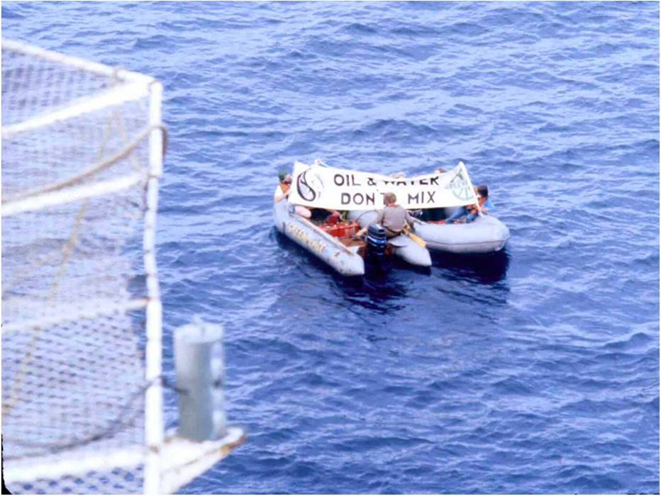
A bit of history: We experienced Greenpeace protesters on Georges Bank way back in 1981. They were dispatched from the Rainbow Warrior which visited the Zapata Saratoga, 155 miles SE of Nantucket. Given the remote location, the protest was unexpected. However, the drilling operation was not disrupted and no action was taken against Greenpeace. Four years later, the Rainbow Warrior was bombed by French commandos while in port in Auckland, NZ prior to planned protests against French nuclear testing in the South Pacific. Sadly, one crew member was killed during this incident.
Greenpeace protesters at the Zapata Saratoga on Georges Bank, 1981
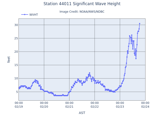
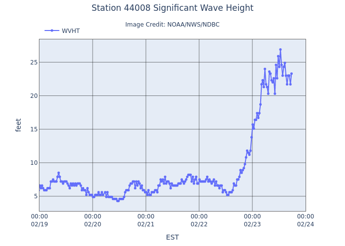
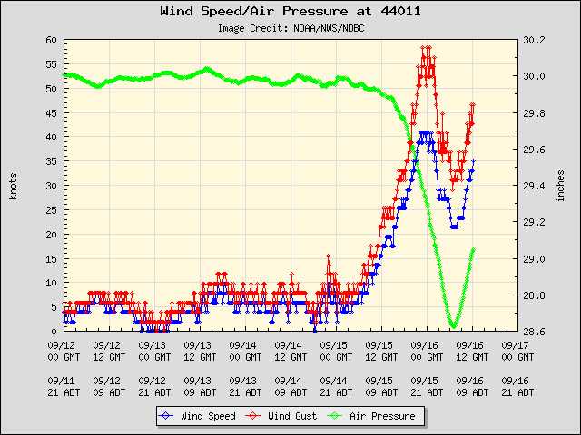
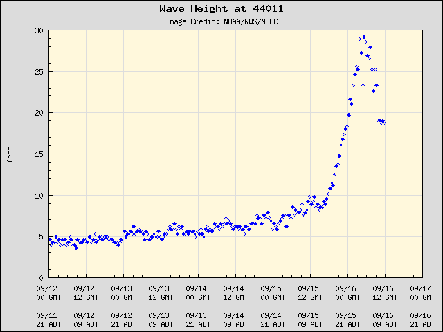
The worst conditions were relatively common by Georges Bank standards. Per the NOAA data buoy (see plots below), the wind speed peaked at 40.8 kts, gusts at 58.3 kts, and wave height at 29.2 ft.
Looking back at my Georges Bank Exploratory Drilling paper (1983), a spring storm in April 1982 generated 105 mph winds and 35 foot swells. I’ll post information on the rig performance issues during those operations at a later date.
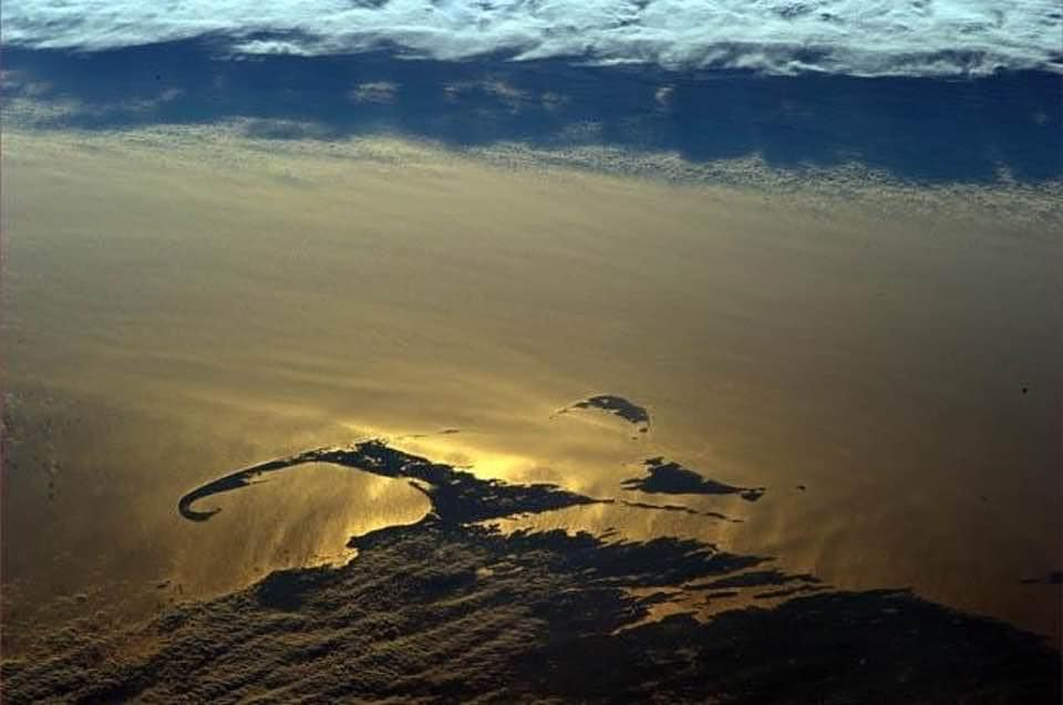
This wonderful satellite image of Cape Cod, Nantucket, and Martha’s Vineyard was posted by a Facebook friend. Cape Cod is quite young, having been formed by a retreating glacier about 20,000 years ago.
I moved to Cape Cod 43 years ago in preparation for the exploratory drilling operations on Georges Bank. I met so many amazing and supportive people during my 4 years there including (most importantly) my wife, State and local officials, congressional representatives, Woods Hole scientists, fishermen, reporters, airport officials, industry representatives, Coast Guard officers, offshore workers, environmental activists, and concerned citizens. All contributed to an outstanding work experience for me and my colleagues.
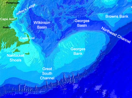
The 8 exploratory were at locations 112 to 155 miles SE of Nantucket (map below).
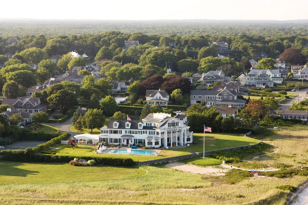
I lived in Hyannis, not far from the Kennedy compound (pictured below) which was on my jogging route. It was an easy bike ride to our office at Barnstable Municipal Airport, where we departed to inspect the exploratory drilling operations.
RFK Jr. talks about the Kennedy compound and the “Camelot years” during JFK’s presidency.


